
Travel Update 4: Ushuaia
- Graham Zell
- Feb 2, 2025
- 9 min read

Updated: Feb 2, 2025
On New Year’s Day, Kris and I were up early to catch a cab to the Buenos Aires airport and get on a flight to Ushuaia, the southernmost city in Argentina, South America, and the world. Puerto Williams, in Chile, on the opposite side of the Beagle Channel, also claims the title of the world’s southernmost city, but it has a population of roughly 3,000 contrasted with Ushuaia’s 86,000, so I’ll side with Ushuaia in this and give “world’s southernmost town” to Puerto Williams. It was exciting to take off from Buenos Aires and see the flat, green squares of Argentina’s agricultural heartland marching into the distance, and descend into Ushuaia a few hours later with the mountains of Patagonia rising from the ocean to touch the low clouds.
Patagonia, the Place
For those of you who are like me and are like, “yeah, Patagonia is a name I recognize. It’s, uh, in the southern part of South America somewhere...” let me help. Patagonia covers basically the whole southern portion of South America, from roughly 38 degrees south latitude to the southern tip of the continent, at 55 degrees south latitude. The northern limit of Patagonia, geologically, is the Huincul Fault, which cuts across a bunch of significant geologic structures and “forms a major discontinuity.” (huge thanks to Wikipedia for making me sound smarter than I am)
Sidebar: If you’re looking for a way support a worthy project, Wikipedia is a great one and it helps them enormously to set up automatic monthly donations, even if it’s only $2-5 per month. In fact, donating $2 per month is more helpful than donating $25 per year, because it makes their cash flow more reliable for planning purposes (and you’re less likely to forget to do it!)
On the west side of the continent, Patagonia is famous for its spectacular mountain peaks, beautiful lakes, and massive ice fields and glaciers. There are multi-day ferries similar to BC’s Inside Passage ferry that make the trip up and down the coast to deliver goods and people to remote villages, and can be a spectacular way to see the continent from the ocean. The prevailing winds come from the west, which bring plenty of rain, snow, clouds, and wind to the region and contribute to the massive Southern Patagonian Ice Field. On the east side of the continent, the land is flatter, descending in stepped terraces towards the Atlantic Ocean, and the climate is dry to the point of being nearly desert-like. Argentina claims the land east of the mountains, while Chile claims the fjords of the west coast, and the border between the two countries falls somewhere in the remote mountain regions. The region is geographically, culturally, and climatically diverse, and the most famous portions of it are probably the trekking routes like the W trek or Mount Fitz Roy (aka, the Patagonia clothing brand logo).

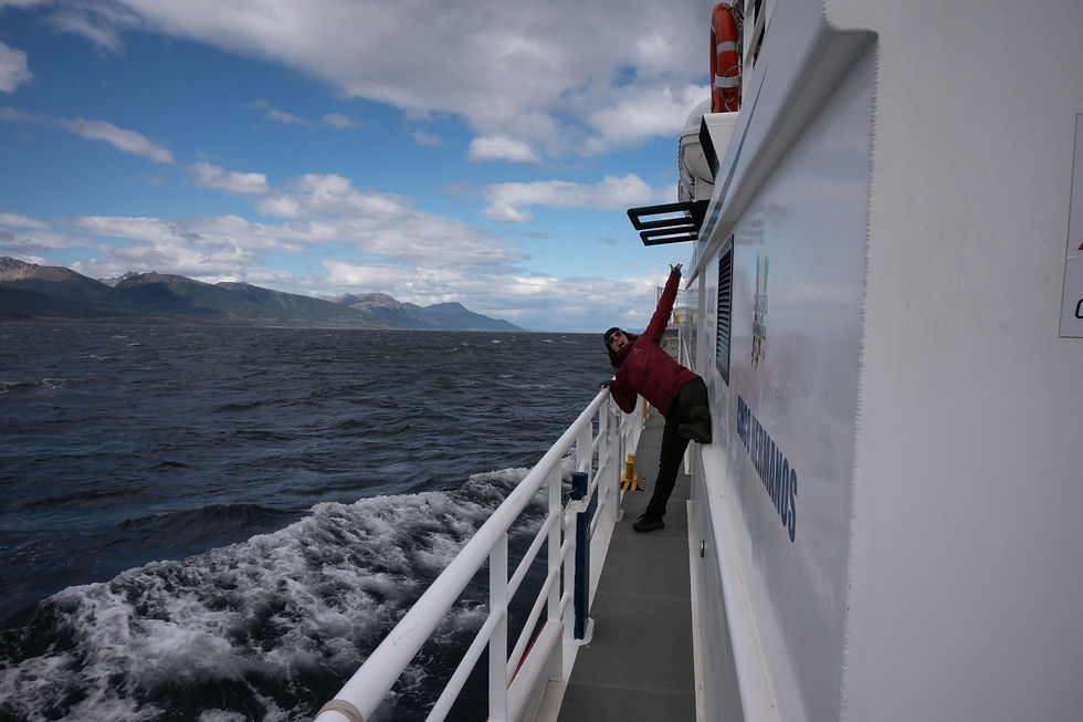
So on January 1, 2025, Kris and I found ourselves near the southern tip of the continent, watching sun and cloud trade places every five minutes and the wind whip the water of the Beagle Channel (named for Charles Darwin’s ship) into playful whitecaps. It took us a day and a half to settle in to our room and find our feet in the town, since the heat of Buenos Aires and the travel to Ushuaia had taken a bit of a toll, but then we were up and going. On our first day out, we found a package that brought us to the Parque Nacional Tierra del Fuego, gave us a ride on the historic prisoner railway (yay?), and then transferred us to a catamaran cruising the Beagle Channel to visit a few sites, notably a seasonal colony of Magellanic and Gentoo penguins (yay!).
The Prison Train
Ushuaia was founded as a prison town, where prisoners from Buenos Aires and the rest of Argentina would be sent to either give them a chance at reform or make sure there was nowhere to go if they escaped, I’m not sure which. Some prisoners apparently transferred to the colony voluntarily, for the prospect of land, freedom, and good work when they completed their sentences. There was also a sizeable population of political prisoners. The prison was shut down in 1947 because of abuse and mismanagement, and exists today as a museum.
The prisoners were put to work harvesting timber and firewood, building the town. and constructing the Southern Fuegian Railway (which was mostly used by prisoners, to shuttle out to work sites to harvest rock, sand, and lumber), aka the Train of the End of the World. Much of the line was damaged in an earthquake in 1949, and the line was shut down in 1952, but the remaining few kilometres are protected as a heritage railway.

I’m going to be honest: the train experience was a laughable bust, and I wouldn’t recommend it unless you have been on literally every other train in the world. The scenery is decent, I’ll give it that, but the trains don’t feel like they have any romance to them. The engines still run on steam, but they’re fuelled by diesel instead of wood or coal, which, while safer, more fuel efficient, and easier to operate, lacks a certain “heritage” feeling. The park has shut down most of the bathrooms in the park aside from at the train stations, and the terminus of the line (the Post Office at the End of the World) is in such a state of disrepair and decrepitude that it’s no longer open to visit. Given that there are only three stations on the line and the other two feature (1) a bathroom, and (2) a waterfall, this really pulls down the average. And for the final punchline, the engine on the train we boarded was on backwards. Seriously. On a scale of heritage attractions, with 10 being Stonehenge at dawn on the summer solstice, and 1 being Stonehenge II at any time of the year, the Railway at the End of the World rates a 2.
For reference for the BC locals, I’d score Barkerville at 8/10 — strong in historical accuracy, interactivity, costume design, humour, fun, and variety of activities, weak in depth of time and importance to world history.
(Kris would like it to be stated, for the record, that she totally called it that the train would be rubbish. Kris, you were absolutely right.)

Penguins!
After the train, though, there was the boat. We boarded a catamaran with about one hundred twenty other tourists and set out into the Beagle Channel. The first view we got to take in was looking back towards Ushuaia and seeing the town nestled against the mountains, and the green of the tree line climbing up and down along the slopes underneath the beige and grey shale of the peaks. The treeline at that latitude ranges between 600 and 700 metres above sea level, so even though the mountains aren’t scraping the upper atmosphere they still manage to tower majestically over the ocean. We visited a two bird colonies — terns at the first, cormorants at the second — nestled on tiny stone islands bare of almost everything except bird nests and streaks of guano, and then a sea lion colony where fifty or sixty sea lions had hauled themselves out of the water to nap, mate, and try to bite each others’ faces. The dominant male was significantly bigger than every other animal on the rock, with a massive “mane” of blubber around his throat and a small harem of females surrounding him, while the younger males more closely resembled the females. The boat pilot did a truly impressive job of keeping the boat close to the rocks in a narrow channel with strong currents.


We then cruised east along the Beagle Channel for a good hour or two until we reached Isla Martillo, where a colony of penguins lives for part of the year. We weren’t allowed off the boat (you have to pay through the nose for that!), but the catamaran brought us as close as it possibly could to the gravelly beach. And by “brought us as close as it possibly could,” I mean it plowed directly into said gravelly beach and turned the engines off. The little guys were apparently used to this sort of thing, as they moved out of the way a little bit and then returned to their normal and obviously very important penguin business. The first thing that I noticed was the smell: the colony reeked of fish and wet salty feathers. The second thing I noticed was the contrast between how awkward the penguins were on land — short hopping steps, with their flippers held stiffly for balance while walking — and how sleek they were in the water. Kris captured a moment on video when four Magellanic penguins turned on their underwater warp drives and curving trails of bubbles in the water as they shot along the length of the beach, and a little later we watched a pair of Gentoo penguins swim towards the beach at top speed, curve upward as they reached the water’s edge, and pop out of the water with enough momentum to carry them a foot into the air and two feet onto dry land where they landed on their feet and began the slow waddle up to the grass. We decided that “penguin energy” embodies loyalty, determination, hardiness, parental care, and a mixture of goofiness and grace.


Hiking
Over the next couple of days we visited the Martial Glacier hike, which used to be the last free thing to do in Ushuaia, but someone had the bright idea to turn the old ski area into a sightseeing venture and now there’s a glitzy sign, a fence, and a ticket booth where the road ends and the trail begins. We just walked past the booth while someone else was paying for a ticket, though, and as there was no one to say “hey, get back here!” we were able to disappear around the first bend in the trail without being noticed. It was a similar thing in the national park: there’s an entrance fee, but the systems for collecting it are so disorganized that you could probably get off your tour bus, mill around aimlessly with the rest of the tourists for a few moments, and get back on with everyone assuming you’d paid the ticket. Later, in El Calafate, the bus station asked everyone to pay a municipal tax, but since there was precisely zero enforcement it was more like a voluntary donation. Anywhoo. The hike was good exercise, and it was fun to see the town of Ushuaia from a different perspective, but there’s not much left of the glacier. If you can’t sneak past the gate, it might not be worth it.
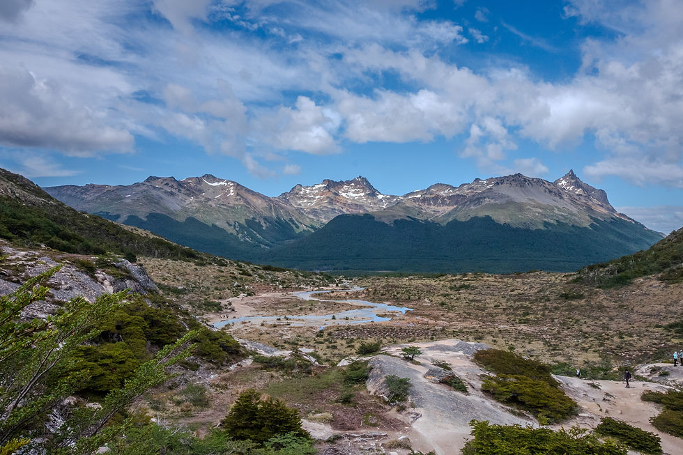
The next hike we did, though, was much more worthwhile. We caught a local bus from the station near the port to a trailhead about twenty minutes outside town, and hiked a few kilometres up to an alpine lake called Laguna Esmerelda. We passed a beaver dam and lodge on the way — back in the day, colonists imported twenty pairs of beavers from North America to breed them for pelts. Almost predictably, the beavers escaped and began to both thrive and cause radical ecological shifts in their new natural-predator-free environment, and neither the Argentinian nor the Chilean government wants to spend money to exterminate them. They’re spreading north anywhere they find suitable habitat, and although the tour guide from the national park optimistically assured everyone that the beavers will be held at bay when they get far enough to reach puma territory, I’m going to put my money on the pumas spreading south and causing more problems while the beavers keep on trucking back to Canada.
Laguna Esmerelda is one of those hikes that one of my favourite hiking guides, Don’t Waste Your Time in the Canadian Rockies, would probably rate as an enthusiastic 4 out of 4 bootprints. It’s an easy hike that, because of the low elevation tree line, gets out of the forest quickly and is full of beautiful views. It’s popular, nearly to the point of being overcrowded, but it’s easy to see why. Kris and I got to the lake easily enough, played around with our cameras for a while, and ate lunch and enjoyed the sun and the breeze. Then we headed back down the trail, said farewell to the beavers, and caught our bus back to Ushuaia.

Ushuaia
Ushuaia as a city was charming, with plenty of cute coffee shops and an astonishing number of souvenir shops. It has a cruise ship terminal, which means that a huge amount of the city’s economy revolves around tourism, and is one of five “Antarctic Gateway” cities worldwide, the only other one in South America being Punta Arenas in Chile.
The two things I remember most about Ushuaia are the wind, which felt like it was always blowing to some amount, and how late it stayed light outside. Because we were there so close to the summer solstice, and because it’s so far south, it was light outside until nearly 11:30 pm. That made it hard to get to sleep at a time that felt normal for me, and difficult to get up early, so my entire sleep schedule drifted east a few time zones.
I’d definitely visit again, and plan some time to learn more about the indigenous people of the Tierra del Fuego region, explore the prison museum, and get on a cruise to Antartica. That’s a bucket list item for sure!
Punta Arenas and Onwards
We left Ushuaia for Punta Arenas after a week there, and for such a short distance on a map the bus ride was looong. There was the border crossing to exit Argentina, the border crossing to enter Chile (two separate checkpoints, separated by a few hundred metres of no-man’s land), a ferry to get to mainland South America, and then a search of the bus by a drug dog. We had a pretty efficient experience, but if the weather had been bad or a passenger had gotten hung up at the border, I could see it taking way longer. Punta Arenas was our one-night stop before continuing to Puerto Natales, and just like Ushuaia it was founded as a penal colony, is an Antarctic Gateway city, and claims the title of the world’s southernmost city. That’s three contenders for “world’s southernmost city” in one blog update, so I’m going to stop here before Nunavut tries to get in on the action.
If you’re reading this, I hope you’re well! Sending you each lots of love from Chile ❤️ More photos are online here: https://adobe.ly/3CCKYfZ
